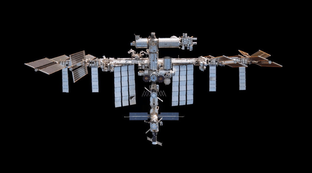
In May the ARISS (Amateur Radio on the International Space Station) is sending Slow Scan TV Images down to earth. Anyone interested can receive and decode these images for fun and enjoyment. It’s kind of a thrill to hear the signal rise up from the static and see an image start to form. All you need is a slightly better than average rubber ducky UHF antenna, a computer program to decode the audio into an image, and some patience. You just walk outside at the right time and point your antenna directly at the ISS which should be right over … uhhh … err … umm … there?
So how do we actually point an antenna at the ISS. Sure, I know the answer is “Somebody does some math and tells me where to point the antenna.” but how do they actually “know”? Like how would I describe to a random guy in Minnesota where the space station will be tomorrow at noon? I can’t tell him directions and times because his directions and times will be very different from mine. I need some way to describe the orbit of the space station in concrete terms. I need to give him a set of figures that he can use to sus out exactly where the station is going to be relative to HIM at any time so he can figure out which way to point his antenna and when.
What information does he need to figure out where the ISS is currently from his point of reference? How do I know which direction I am pointing when I’m sitting on a spinning ball flying around another spinning ball while travelling through a vast area of nothing?
Minnesota is either hurtling end over end through space at ludicrous speeds in a wild spiral inside another wild spiral … OR it is sitting perfectly still between Wisconsin and the Dakotas … depending on where you are when you look at it.
How am I going to define the location of the space station to a stranger … who doesn’t speak English … and he uses nautical miles and knots for measurements … in a single text messsage?
Well lucky (or not) for you, I am a U.S. Air Force veteran who sat through a many months long tech school that included an section on Orbital Dynamics and I’ve been in the satellite industry for most of my career.
Way back in the day, eager young SSgt Terrell wondered “Everything is always moving and tumbling through space, How do you even describe an orbit anyway?” He was answered by the instructor with the question “What is the velocity and location of a thrown baseball?”.
Well … if it is thrown straight up, the velocity is zero at the very top and constantly changing the entire flight. But if you have the answer to “How long did the baseball stay in the air?” (in standard earth gravity in a vacuum) then you can derive how high the baseball was thrown. If you also have the answer to “How many times a month would the baseball circle the earth if it didn’t land?” and “Relative to Home plate, what was the vector to the baseball when it as at its highest point in flight and what exact time was it?” then you can calculate the location and speed of the baseball anywhere and anytime in its flight. That is sort of how the TLEs work. The TLE gives you the answers to some questions about exactly where the baseball was a little while ago, where it will be the highest in its flight, and what direction it will be heading, and lets you calculate the location and speed relative to your position.
So how exactly do I describe where something is when my friend in Minnesota when HE is in motion, the ISS, everything around the ISS, and I am also moving through space at different speeds? Well, what we need is just a few fixed points! These points just need to be reasonably easy to measure and universally understandable.
Let’s begin by drawing an imaginary line from the center of the Sun through the center of the Earth at EXACTLY the beginning of spring in the northern hemisphere. That mathematical chalkline we just snapped is called the “Vernal Equinox” and it is used as an inertial reference. Just like a toy gyroscope, wherever you go, however you flip around, it will always point in that same direction.
Now instead of leaving it at the center of the sun, pretend the vernal equinox starts at the center of the Earth as we orbit around in space and we now have two of our needed imaginary references. We have the center of the Earth and the Vernal Equinox we are carrying with us. We also have the Earth’s equator as a reference and we can count the number of times the satellite goes around in a day. Now we get ourselves a very accurate clock. We are ALMOST there! The only thing missing is the ability to describe angles. We use the Babylonian “a circle is divided into 360 degrees” model we all learned in school and PRESTO we have everything we need to describe our satellite orbit and to predict where it will be!
Now we just need a way to efficiently communicate all these “facts” to Minnesota. We need to come up with a format to transfer these things. That format is called a TLE.

What is a TLE?
Well, this is:
ISS (ZARYA)
1 25544U 98067A 26128.19937109 .00004920 00000-0 96926-4 0 9999
2 25544 51.6308 138.0417 0007476 35.9089 324.2400 15.49139257565554
Two-Line Element (TLE) sets are ASCII text files used to describe the orbits of Earth-orbiting satellites, with each data line consisting of exactly 69 characters. The format is designed for legacy, fixed-width ASCII compatibility, commonly 2 lines, but sometimes featuring a 3rd “name” line (3LE).
Just like _SO_ many things in our world today, it all started with a stack of good ole 80 column computer punch cards. That 80 column restraint was the driving force behind the creation of the Two Line Element set (TLE). If IBM had only created a 60 column punch card we would probably have a “Two and Two Thirds Line Element” set (TATTLE). Writer’s note: I just made that joke up and I am quite proud of it. 🙂
The simplest way to think of a TLE is as a description of an orbiting object’s motion at a specific time known as an epoch. For example, if a user knows the precise orbit of a satellite and where a satellite was in that orbit at a specific time a few hours ago, they can predict where it will be using a few calculations.
A TLEs doesn’t pinpoint an object in space and give it a speed and direction and then let the user work out the orbit. They work the problem from the opposite direction. A TLE accurately describes the orbit of a satellite and then pinpoints its location around that orbit at a precise time. This leaves the user (computer) to calculate where the satellite is located around a known orbit rather than to calculate an orbit based on location and speed and influence of earth/moon/sun/etc. I was told this approach makes the calculations easier and more precise, but I don’t really know why.
Example TLE
This is an example TLE of the International Space Station. TLE data for most spacecraft can be downloaded from https://www.space-track.org/. Space-Track is a public database maintained by the United States for tracking all orbiting satellites and space junk. This is the latest TLE for the international Space Station:
ISS (ZARYA)
1 25544U 98067A 26128.19937109 .00004920 00000-0 96926-4 0 9999
2 25544 51.6308 138.0417 0007476 35.9089 324.2400 15.49139257565554
Admittedly, the format is a little weird, but again the TLE data was originally designed to fit onto 80 character punch cards. Let’s break down what all these numbers mean.
Header
| Data | Meaning |
| ISS (ZARYA) | The human-readable name. (Optional) This line only exists because humans are forgetful disorganized meat sacks who can’t memorize the SpaceCat |
Line 1
| Data | Meaning |
| 1 | Line 1. Duh |
| 25544 | Norad ID of the object. |
| U | U=Unclassified. C=Classified. S=Secret. |
| 98067A | International designation ID |
| 26128.19937109 | Epoch time data. 128.19937109th day of 2026. (Sometime in early May). This is the exact moment in time that this TLE represents. Anything before or after this time must be calculated. |
| .00004920 | First time derivative of the mean motion. This is how fast the speed of the item is changing over time. i.e. It is slowing down by .00004920 orbits / day2 See how we use orbits / day2 instead of km/h. We don’t know what this value means until we calculate the orbit. |
| 00000-0 | Second time derivative of the mean motion. This is how fast the “speed the item is changing over time” is changing over time. It’s Speed-ception! i.e. The First derivativ of mean motion is changing by 0. Most modern TLEs this will be 0. |
| 96926-4 | BSTAR (B*) drag coefficient. (96926-4). This value used for calculating the drag caused by the very thin atmospheric drag in near space. This is similar to a ballistic coefficient in firearms, and is just a value that quantifies the “drag” that is slowing the satellite down. Yes there is drag in orbit, Just not much of it. |
| 0 | Ephemeris type (usually zero). No idea what this means. |
| 999 | Element set number or serial number. |
| 9 | Checksum (mod 10). This just makes sure the data is valid. |
Line 2
| Data | Meaning |
| 2 | Line 2. Both lines have the Line number and Norad ID because nerds occasionally drop stacks of punch cards on the floor when they are walking into the data center. |
| 25544 | Norad ID. Both lines have the Line number and Norad ID because nerds occasionally drop stacks of punch cards on the floor when they are walking into the data center. |
| 51.6308 | Inclination in degrees. How tilted the orbit is relative to the equator. |
| 138.0417 | Right ascension of the ascending node (RAAN) in degrees. This is where the satellite will pass the equator heading north next time it comes around. This is measured relative to the vernal equinox. The vernal equinox points from the center of the Earth toward the Sun at the exact moment of the northern hemisphere spring equinox. Basically it is just a fixed imaginary vector in space. Everything up there is always moving, so they had to come up with something to reference. |
| 0007476 | Eccentricity of the orbit. (0.00191) 0 < 1 is an orbit, > 1 is an object with escape velocity leaving the earth. The closer to 0 the more circular the orbit. |
| 35.9089 | Argument of the perigee in degrees. This is where the satellite is closest to earth relative to the Right ascension number of the ascending node RAAN. So in this case, the ISS will be at its lowest point in the orbit about 75 degrees around the earth from when the ISS crosses the equator heading north. |
| 324.2400 | Mean anomaly in degrees. This says “at the exact time of this TLE, the ISS was 324.2400 degrees past it’s perigee. Hey! this is the only term we have seen that actually defines where our satellite is instead of describing the orbit! |
| 15.49139257565554 | Mean motion AKA revolutions around the earth per day. We don’t know how fast the satellite is, but we know enough about it to calculate the orbit and we’re given how many times it goes around. |
| 56555 | The total revolution count at epoch. The ISS has gone around the world 56555 times! |
| 4 | Checksum (mod 10). This just makes sure the data is valid. |
So did anyone else notice?
The “360 degrees make a circle” unit was the ONLY arbitrary human invented definition used in the whole TLE? Everything else was an observable naturally occurring measurement. There weren’t any “kilometers per hour” or “feet above MSL” or any other units. Everything else is described relative to the earth or the orbit itself. Mr. Minnesota needs to have an accurate clock set using the stars, he needs to know that 360 degrees make a circle, and he needs to be able to observe and measure and record the world around him. That’s It! He can make his calculations in “hogsheads per hectare” or “femtoseconds per strawberry”, whatever floats his boat.
The orbit is defined and the satellite is placed at a specific point at a specific time. To figure out where our ISS is right now we just run this model forward or back in time and let the physics give us the answer. Science is COOL!
Here’s a website where you can play with real examples:
Note: TLEs have limited accuracy and should be updated regularly (roughly every 1–2 weeks) to ensure reliable predictions. This is the “three body problem” in the true sense. Tiny rounding and measurement errors in calculations will compound and make the data unusable in short order

Leave a comment